
*CLICK IMAGE TO VIEW LARGER


Property Description
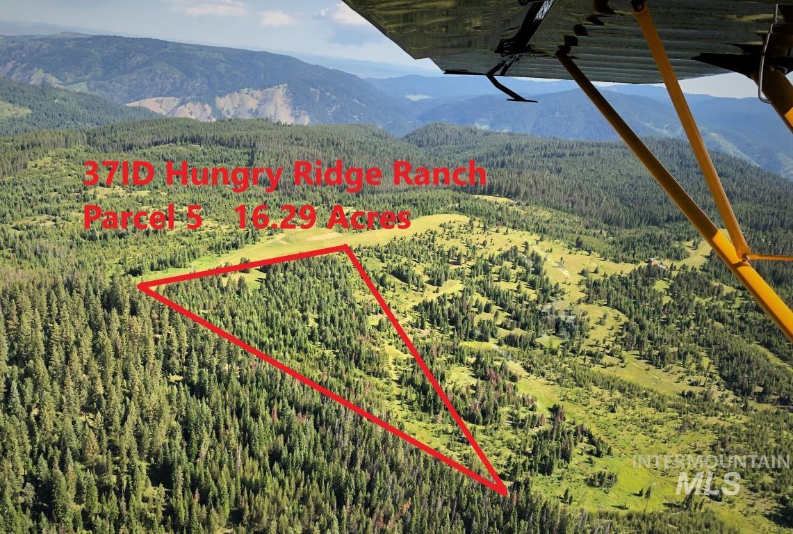
HUNGRY RIDGE RANCH Fly-In or Drive-In THE BEST of Clearwater Country! Gateway to the Idaho BackCountry. 20 large parcels within 400-acre Private Ranch surrounded by USFS. 2246ft LANDING STRIP (37ID). Driving from Grangeville 19 paved miles, then 8.7 miles on a USFS Primary Access Road. Mountain Views! World Class hunting & fishing! Close South Fork Clearwater River. Numerous USFS trails for 4WD, snowmobile, mountain bike, hike, horses & white water boating. Unsurpassed Road Access to Gospel Hump Wilderness, Frank Church River Of No Return Wilderness and Selway Bitterroot Wilderness. Hwy 14 continues on to Elk City, Red River, Dixie, Mackay Bar, Mallard Creek, Whitewater Ranch and the Magruder Corridor on to Darby MT. Best accessible BackCountry property in all of Idaho!$299,000
N/A Baths
N/A Beds
N/A
16.29 Acres
N/A Sq Ft
0.00/Sq Ft
Type: Unimproved Land
Built In N/A
More In: 0 Not Applic.
More In: Idaho County - 1950
Mortgage Calculator
REQUEST INFO
EZ Copy paste link:
www.jackierosebuyidaho.com/propertydetails.cfm?searchtype=mls&mlsid=98909365
www.jackierosebuyidaho.com/propertydetails.cfm?searchtype=mls&mlsid=98909365
Listing Status:
Active
Price:
$299,000
Area:
Idaho County - 1950
Type:
Unimproved Land
Lot Size:
16.29 Acres
Acres:
16.29
Est Taxes:
$38.56
Tax Year:
2021
Days On Market:
3
Subdivision Code:
0 Not Applic.
Water:
Proposed Well
Docs On File:
Survey/Plat, CC&Rs, Lengthy Legal Description
Listing Date:
2024-05-05
Listing Date:
2024-05-05
Lot Features:
10 Acres - 19.9 Acres, Level, Sloped, Solar Potential, Surveyed, Views, Wooded, Borders Public Owned Land
Terms:
Cash
Listing Data Last Updated 05-18-2024
 All listing provided by IMLS are marked with the official IMLS IDX logo.
Information courtesy of: Flying Brokers / Intermountain Multiple Listing Service
THIS INFORMATION IS DEEMED RELIABLE, BUT NOT GUARANTEED
All listing provided by IMLS are marked with the official IMLS IDX logo.Information courtesy of: Flying Brokers / Intermountain Multiple Listing Service
THIS INFORMATION IS DEEMED RELIABLE, BUT NOT GUARANTEED

